







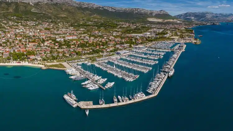
The Croatian Hydrographic Institute (HHI) has issued two current navigational warnings pointing to changes to harbour lights. Affected are Marina Kaštela near Split and the small harbour of Bakarac in the Kvarner region. Especially at night and in poor visibility, skippers should be aware of the changes and should not rely solely on older charts or plotter data.
Anyone cruising along the Croatian Adriatic coast in late August should take note of two new navigational warnings from the Hrvatski hidrografski institut (HHI). The Radio Navigational Warnings 312/2026 and 313/2026 concern only very small sea areas – but for skippers entering a harbour there at night, they can certainly be relevant.
Marina Kaštela: new red harbour light on the breakwater
Navigational warning 312/2026 of 27 August 2026 concerns Marina Kaštela in the Kaštelanski zaljev west of Split. A new harbour light has been installed at the western head of the breakwater there.
The light stands at position 43° 32.683′ N / 016° 24.333′ E (WGS 84). It is a red light corresponding to lateral buoyage, mounted on a red tower. Its characteristic is Fl R 3s: one red flash every three seconds. The light height is five metres, with a nominal range of two nautical miles.
Important for the approach: The light has an obscured sector between 033 and 114 degrees and is therefore not visible from that area. The HHI explicitly calls for cautious navigation.
The notice is particularly relevant for charter crews: Marina Kaštela is one of the major charter bases in the Split area and is therefore frequently visited by crews unfamiliar with the area. The new light should therefore be factored into passage planning for a night-time approach.
Back in July, the HHI had already reported two new white harbour lights at the heads of the marina’s western and eastern jetties. The nautical marking of the facility has thus been supplemented several times within a short period.
SeaHelp tip: Anyone approaching Marina Kaštela at night should not be surprised if the lighting actually visible differs from an older chart edition. Update plotters and electronic charts before setting off, and take the current HHI navigational warnings into account when entering harbour.
Bakarac: harbour light currently out of service
With navigational warning 313/2026 of 28 August 2026, the HHI reports almost the “opposite problem” from the northern Adriatic.
In Bakarac, south-east of Rijeka and directly south of the entrance to the Bay of Bakar, the harbour light at the head of the pier of the Stara lučica, the old small harbour, has failed. The light affected is PS 203 / E2862 at position 45° 16.82′ N / 014° 34.86′ E. The HHI currently lists it explicitly as “unlit”, i.e. extinguished.
For skippers, this means increased vigilance is required, especially in darkness. A light signal shown and expected on the chart or plotter is currently not present. Especially when approaching a small harbour facility, this can considerably hamper visual orientation.
SeaHelp tip: Only approach Bakarac in darkness with particular caution, reduce speed in good time, and do not rely on actually seeing the harbour light shown on the chart. GPS and plotters are an important navigational aid, but when entering harbour they replace neither a proper lookout nor a safe speed.