
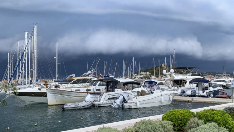
A severe storm in Croatia with storms, heavy rain, thunderstorms and hail in its wake spread from northern Italy to Istria, the Kvarner and large parts of Dalmatia as early as the evening of 3 August, and by 4 August 2020 had spread over the entire Adriatic region. In the coastal area, the authorities registered considerable damage: fallen trees, flooded roads, full cellars and numerous fires caused by lightning strikes were the result of the powerful low pressure system that hit Croatia. The weather services issued advance warnings, and SeaHelp also sent a severe weather warning to all smartphone owners who had installed the app via the free SeaHelp app.
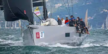
Despite the warnings, a few skippers obviously underestimated the force with which the storm cell discharged. As a result, the telephones in the SeaHelp operations center did not stop ringing, and the rescue boats of the individual bases were virtually in continuous operation due to the storm. The problems reported by worried skippers ranged from medical assistance, grounding, engine problems, to free capacity in marinas.

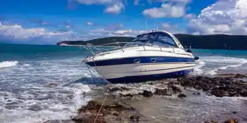
Damage to boats in yachts relatively limited
Nevertheless, the SeaHelp summary is: “In view of the severity of the storm, relatively little damage occurred in the end because the majority of the skippers took the warnings of the weather services seriously and sought shelter before the bad weather front reached them.
Storm came with delay
A skipper, who was lying in Tribunj: “Actually storms were already reported for Monday. But we noticed that the wind from the south was freshening up strongly and the typical thunderclouds formed. Therefore we had decided to stay in the Marina Tribunj on Tuesday. A good decision, as it turned out later. On Tuesday afternoon the thunderstorm front reached us around 16.00 o’clock. The heavy rain lasted relatively long, at least by Croatian standards.”
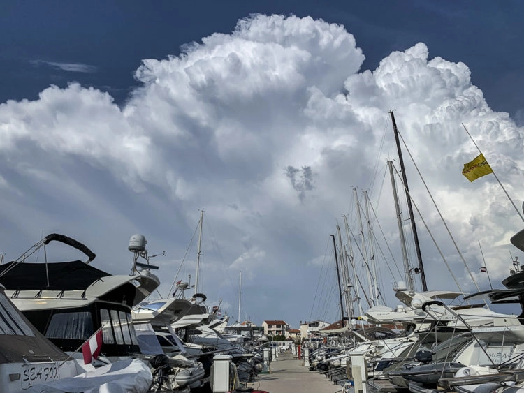
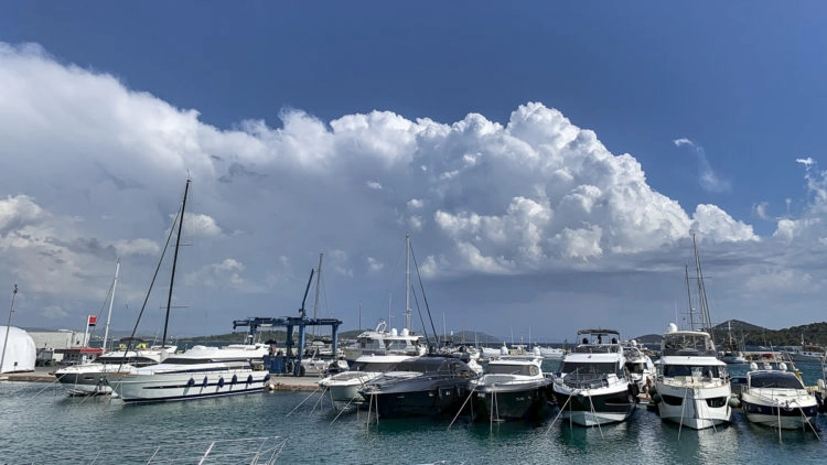
Situation built up
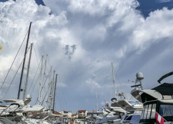
The situation had slowly but surely built up. A hot spell with high temperatures even for Croatian conditions and a water temperature of almost 28 degrees Celsius in some places made the air highly saturated with water. “Every morning the ship was wet,” said another skipper. It simply had to unload itself at some point.
Novigrad: gusts up to 150 km/h reported
In Istria, the northern part of Croatia, the storm began as early as around 14.00 hours with isolated local rainfall, which proved to be extremely productive. But these were only the harbingers of an even stronger thunderstorm cell, which moved from northern Italy towards Istria and caused considerable devastation, especially in Umag and Porec. According to media reports, meteorologists in Novigrad registered wind gusts of up to 150 km/h.
Partial hail
The storm then moved on across the Kvarner towards Dalmatia. In Stomorska on the island of Solta as well as in the west of Kastela, the heavy rain even turned into hail, which is a rarity in this region in summer. Strong southerly winds pushed the water of the Adriatic Sea over the promenades to the old town areas of some towns, and according to the Crometio team the Adriatic Sea rose up to half a meter in some places.
Also in Selce near Crikvenica the sea came over the promenade. Where only a few hours before guests were enjoying their meals, waves sloshed into the restaurants.
As was also reported, a low-pressure trough over 150 kilometres long had formed between Italy and central Dalmatia, accompanied by strong storms. The media also reported damage from Peljesac.

The good side: forest fire danger averted
Even if it is difficult, in view of the considerable damage caused, to take the best out of the storm, there is no question that the danger of forest fires has been averted for the time being by the heavy rainfall, which in some cases exceeds 34 litres per square metre.
More pictures on Facebook and Instagram
With this in mind, SeaHelp again urges that sufficient attention be paid to weather warnings in the SeaHelp App and to warnings from weather services. More about the storm in Croatia also on Facebook, Instagram and of course by updating this post.
Did you also take impressive photos of the last thunderstorm? Share them via Instagram or Facebook or send them to presse@sea-help.eu
How does a thunderstorm develop?

Mit dem Laden des Videos akzeptieren Sie die Datenschutzerklärung von YouTube.
Mehr erfahren