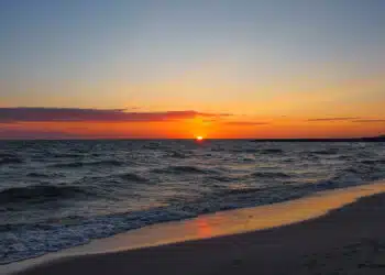

If you have only one week and want to see and experience as much as possible with your own or chartered yacht in these seven days, the D Marin Marina Mandalina in Šibenik on the central Adriatic in northern Dalmatia is just the right starting point. From here, you can either sail west to explore the Kornati National Park (Part 1 of our sailing tip) or head north – in fresh water – up the Krka to Lake Prokljansko and take a trip to the Krka waterfalls (Part 2 follows).
Hardly any other area offers such a great variety in such a small space as the Middle Adriatic in the north of Dalmatia with Šibenik and the many smaller and larger offshore islands. From here it is only a stone’s throw to the Kornati National Park in the southwest or direction WNW along the coast to Biograd (see also our article “Croatia with the yacht: cruise tip Zadar”).
Alternatively, the crew explores on their own keel, sailing up the Krka from Šibenik, the national park of the same name and the waterfalls located to the northeast (this cruise is described in Part 2). There is also much to discover in this (freshwater) area, and several marinas offer their services here, which can also be used as a good starting point for an Adriatic cruise.
Day 1: Mandalina / Šibenik – Biograd
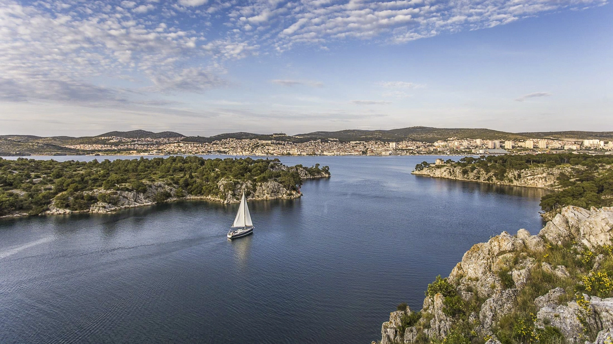
If you start your cruise like we did at D-Marina Mandalina, you should plan time to visit Šibenik. The town, which is located not far from the mouth of the Krka River into the Adriatic Sea at a naturally protected harbor, is separated from the sea only by a natural breakthrough about 2.5 kilometers long, the so-called Antonius Channel (Sv. Ante). No less than two National Parks can be explored from Šibenik: Kornati and Krka (part 2 of our cruise tip follows).
The most important building in Šibenik, which is also called the City of Stairs because of its approximately 2,800 steps, is the Cathedral of St. Jacob (Katedrala sv. Jakova), whose roof consists of a barrel vault of cantilevered stone slabs. The cathedral is included in the UNESCO World Heritage List.
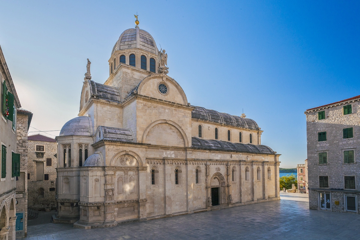
Šibenik is famous for its monuments, fortresses and marina
Šibenik is also famous for its four fortresses, which were once part of the Venetian defense system, and are also on the UNESCO World Heritage List since 2017.
Besides the oldest fortress St. Michael (Tvrđava sv. Mihovil), also St. Anne’s Fortress, built in the 11th century under King Petar Krešimir IV, are the Fortress of St. John (Tvrđava sv. Ivan), the Fortress Baron or Fortress Šubićevac, named after the Venetian general Christoph Martin von Degenfeld, and the Fortress of St. Nicholas (Tvrđava sv. Nikola) at the entrance to the Antonius Canal (Sv. Ante).
Many historical churches and monasteries can be visited in Šibenik, some of whose construction dates back to 1431. But there is more to discover in the town on the Krka River: the Old Town Hall – Town Loggia (Gradska vijećnica – Gradska lođa) on Republic Square (Trg Republike), the Small Loggia (Mala lođa), Zagreb Street (Zagrebačka ulica) with numerous burgher houses and noble palaces and Republic Square (Trg Republike) are just some of the historical buildings worth seeing. However, many visitors also simply enjoy strolling along the Šibenik waterfront in a relaxed manner and stopping here for a drink or dinner.

Mit dem Laden des Videos akzeptieren Sie die Datenschutzerklärung von YouTube.
Mehr erfahren
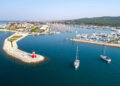
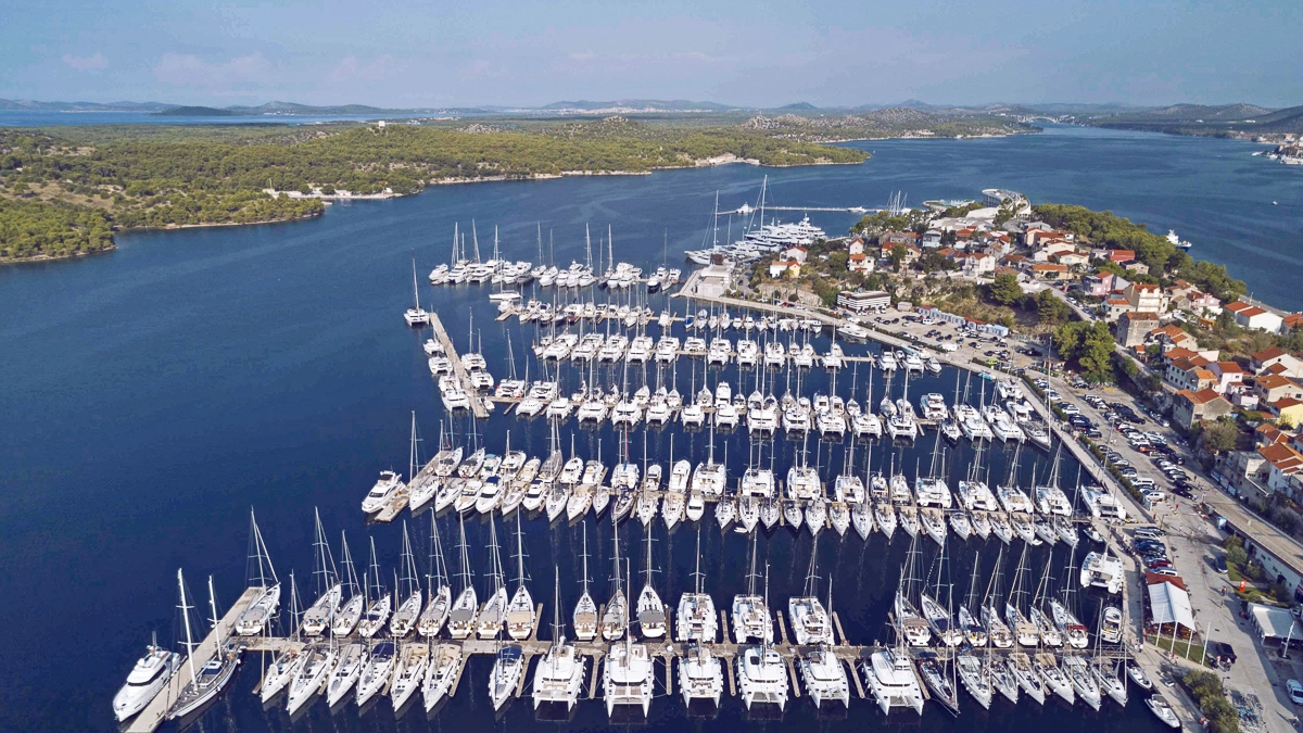
D Marin-Marina Mandalina is suitable for all yachts, including superyachts
D-Marin-Marina Mandalina, Croatia’s only marina designed for superyachts and awarded by the prestigious Yacht Harbour Association of London, is considered one of the safest places to moor in the Adriatic and offer every service a crew could wish for. (See post “D-Marin Tribunj: D-Marin Group expands marina network in Croatia” dated Jan. 12, 2022).
Charter yachts are best moored in the older part of the marina in the bay interior, you moor at comfortably equipped floating pontoons with finger pontoons – note: the fenders should be hung low before entering, as the floating pontoons are quite far down.
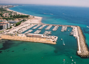
From Šibenik it is only a day trip to the “white city by the sea” Biograd na Moru
We pass with our yacht the about 2,5 kilometers long channel of Sv. Ante, round the cape Rt. Jadrija with its red fire and direct our course to the northwest, passing the islands Prvic and Tijat as well as Murter, until we moor our lines in the Marina Kornati (at the eastern part of the marina area) in Biograd after a nice day trip.
The “white city by the sea” Biograd na Moru, like Sukošan also a popular starting port for sailing trips to the island labyrinth of the Kornati, offers a lot. Beautiful beaches and bays await seaside vacationers, and while during the day life takes place mainly on the beach and harbor promenade of Biograd, in the evening hours the hustle and bustle shifts to the waterfront promenade on the edge of the old town (see also our article on Biograd “Croatia with the yacht: cruise tip Zadar”).
Day 2: Biograd – Levrnaka
The next day we leave Biograd early, because we are planning a longer beat, which should lead us first in a southerly direction to the southeastern end of the island of Pašman. From there, we will continue on a southwesterly course between the islets of Zizanj and Gangaro, and from here we will sail along the north side of the island of Zut with a wonderful wind on a westerly course until we reach the southeastern tip of the elongated island of Dugi Otok (for more on Zut, see already our post “Croatia with the yacht: cruise tip Zadar”).
Here, where the islands of Dugi Otok (or the equally offshore island of Katina), Zut and Kornati and the national parks Telascica and Kornati meet, we continue to sail with a southwesterly course between the islands through. When passing the island of Katina on its northern side (Mala Proversa), it should be taken into account that current can stand up to four knots, and that the maximum allowed speed is five knots; the entrance itself is well marked by a pair of red/green buoys.
Mit dem Laden des Videos akzeptieren Sie die Datenschutzerklärung von YouTube.
Mehr erfahren
The passage on the south side of Katina Island (Vela Proversa) is recommended for shallow-going yachts only; the water here is only about 1.8 meters deep, again a current of up to three knots can occur, and yachts are allowed a maximum speed of five knots.
Mit dem Laden des Videos akzeptieren Sie die Datenschutzerklärung von YouTube.
Mehr erfahren
Attention: at the narrowest part of the passage, it is essential to cover the two stone cones on the south bank ahead and astern! After the passage we finally reach open water. Now, sailing southeast again, we follow the border of the Kornati National Park until we reach the small island of Levrnaka.

We enter the northern bay, coming from the northwest, the moorings here are very limited in number, but there are murings and electric hookups. If you wish, you can visit one of the two restaurants (Konoba Andrija and Konoba Levrnaka) on the island, both of which have their own jetties; in both restaurants it is advisable to make a reservation in advance.
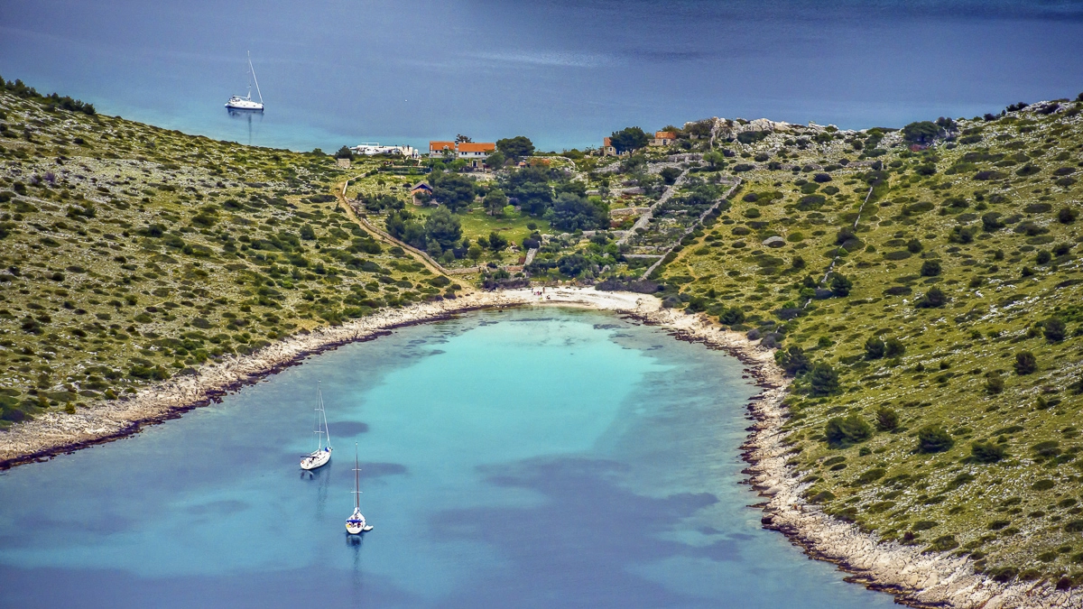
Day 3: Levrnaka – (Kornati National Park) – Opat
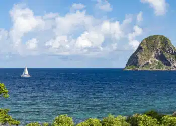
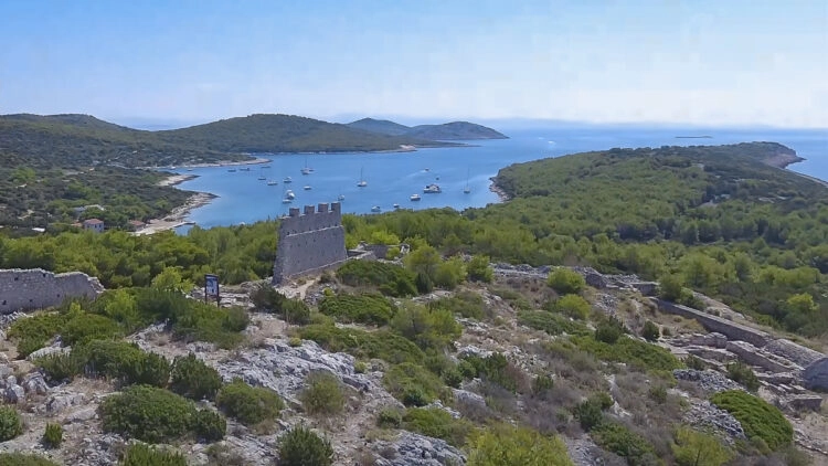
We are now in the middle of the Kornati National Park – a must on the vacation charter cruise list for many sailors. The National Park (Croat. Nacionalni park Kornati), also called Kornati National Park, covers a considerable part of the Kornati archipelago (Croat. Kornatski otoci or simply Kornati), an archipelago in the Croatian Adriatic Sea, and extends southeast to the islet of Samograd, just before the northern tip of Zirje.
The Kornati islands represent the densest archipelago in the Mediterranean and were placed under strict protection as a national park in 1980. The total area of this national park is 220 square kilometers. In total, the national park consists of 89 islands, islets and rocks. The largest of them is called Kornat. The national park administration is located in the village of Murter on the island of the same name not far from the archipelago.
Mit dem Laden des Videos akzeptieren Sie die Datenschutzerklärung von YouTube.
Mehr erfahren
Tickets to the Kornati National Park should be purchased online before the cruise
Attention: there is a fee to enter the protected national park area. Boats passing through the national park area are required to either pay an entrance fee directly on site or pay it beforehand at the national park administration. If you want to avoid the comparatively high marina prices for entrance tickets to the national park on site, it is best to get the tickets beforehand (be sure to tell the marina when paying, this avoids misunderstandings).
We cast off the lines, set main and genoa and sail through the fascinating island world of the Kornati islands further southeast. We pass the ACI Marina Piscera (see also our article “Kroatien mit der Yacht: Törn-Tipp Zadar”) and stop in the small anchorage of Opat at the southern tip of the island Kornat.
If you want, you can stop here (after reservation) in the restaurant Opat; Alternatives are in the northern bay of Koromacna (restaurant of the same name), a stone’s throw away, and in the bay Lojena of the island Smokvica, which is located immediately southeast (restaurants Piccolo and Mare).
Mit dem Laden des Videos akzeptieren Sie die Datenschutzerklärung von YouTube.
Mehr erfahren
Day 4: Opat – Zirje Island
From Opat, we set off the next morning on the water way to the southeast: today we want to explore the island of Zirje. We sail between the islands of Smokvica (on port side) and the elongated island of Kurba Vela (remains on starboard side), first passing the port side protected area of the island of Mrtovnjak at a safe distance (navigation prohibited), then the southernmost island (rocky islet) of the Kornati National Park, Samograd, then the northern tip of Zirje is already in front of the bow.
From now on we sail along the northern side of Zirje, our destination is the bay of Muna, well protected in southern winds. Here there are restaurants and a possibility to bunker. To the actual town with the same name as the island, Zirje, it is only a few minutes walk.
The next bay in the southeast direction is only a few minutes away; in Koromasna there are many (private) buoys, in front of the restaurant (Koromašna) there are some designated mooring places. In northerly winds, a stop on the south side of Zirje is recommended, such as in the coves of Stupica in the south of the island (buoys).
Day 5: Zirje – Kaprije
From the island of Zirje it is only a stone’s throw in a northeasterly direction to the island of Kaprije, a few nautical miles away. If you want to visit the bay of the same name in the south of the island, it is best to sail clockwise around the offshore island of Kakan. There are several restaurants in the bay and 18 buoys in the middle.
Mit dem Laden des Videos akzeptieren Sie die Datenschutzerklärung von YouTube.
Mehr erfahren
If it is too crowded here, you can go to the northern bay Medos of the island; there is also a restaurant (Kunjka) and several buoys and some places on jetties.
Mit dem Laden des Videos akzeptieren Sie die Datenschutzerklärung von YouTube.
Mehr erfahren
Day 6: Kaprije – Zlarin / Prvic / Vodice
If you like, sail from here towards NE, a last leg before returning to D-Marina Mandalin could take the crew to Zlarin, the island of coral and sponge divers, just off the Krka estuary (restaurants, shopping in the bay of the same name in the northwest of the island), moorings are available at the piers on the eastern shore; deeper yachts choose moorings on the south side of the outer pier.
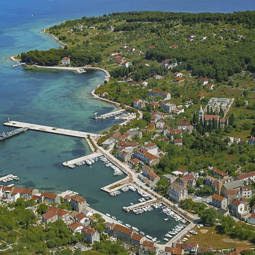
Or you can choose Sepurine (West) on Prvic (with the same service) for a last cruise stop. There are buoys in front of the restaurant south of the pier, and anchoring is also possible in about five meters of water. Attention: the pier is reserved. Those who like it a bit busier spend the last night on the mainland in Vodice, here are ACI marina or city port to choose from.
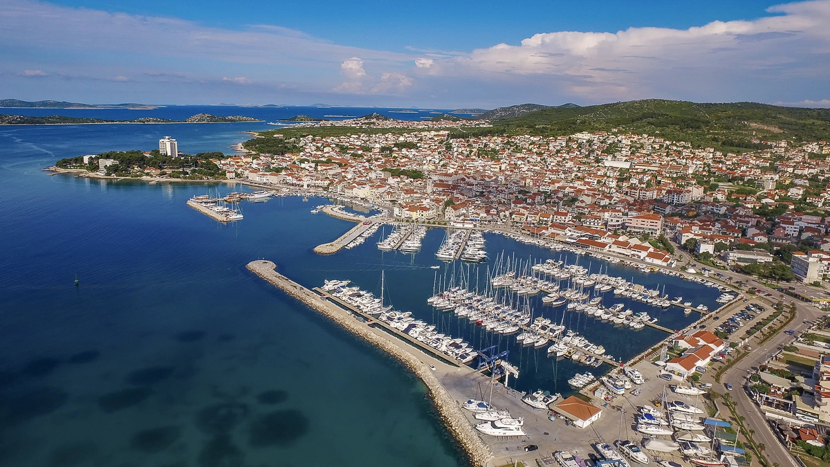
The ACI Marina Vodice offers everything that the sailor and the tourist heart desires
ACI Marina Vodice has 290 mooring places, all equipped with electricity and water and offers a very good comfort. The name Vodice has been handed down since 1402 and goes back to the Slavic voda, which means water. The seaside promenade offers everything a tourist’s heart desires, in addition to several restaurants, cafes and souvenir stores, two open-air discos invite you to visit.
Alternatively to a last cruise stop on Zlarin / Prvic or in Vodice, one can, coming from Kaprije, also sail straight through to the starting point of the week’s cruise, the D-Marin Marina Mandalina; this variant offers itself as a buffer day and for crews who have not yet had the opportunity to explore Šibenik extensively.
Day 7: Zlarin / Prvic / Vodice – Mandalina / Šibenik
Otherwise, the seventh and final day of the cruise is all about returning to Mandalina Marina, which is located south of the city in a sheltered bay and owes its name to the peninsula to which it belongs. The entrance is clearly signposted with large blue letters, and there are 367 berths in all. Enough time to clear the ship and hand over the yacht should be planned.
Interactive cruise map
Mit dem Laden der Karte akzeptieren Sie die Datenschutzerklärung von Google.
Mehr erfahren
Tip from the SeaHelp editors:
For the described trip, many drone photos and 360 degree images are available on our SeaHelp app, so you can already look at many bays in advance and plan your trip perfectly.
Download SeaHelp app: