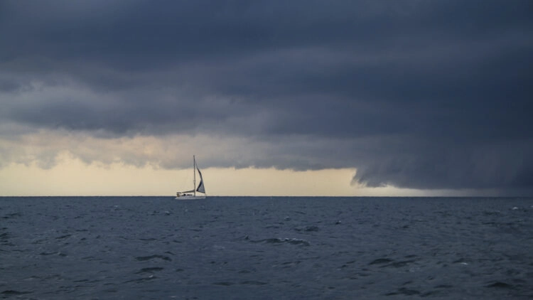
Storms at sea always give anxious moments and questions. To behave properly and give his crew the right answers, here are the biggest misconceptions.
“Thunderstorms? Is rare in Croatia. Never experienced it there.”
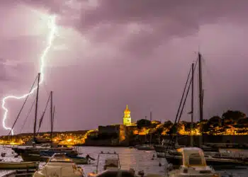
Croatia and the northern Adriatic coast are thunderstorm-rich coasts, especially in the summer months. Statistically, lightning and thunder are more frequent in the northern Adriatic than in our latitudes. Why? The Adriatic is a shallow sea, bordered by high mountains in the north and east. Shallow seas warm up faster in the high summer months, which accelerates evaporation. When sudden blasts of cold air from the Alps or coastal mountains meet hot, humid air masses over the Adriatic, it crashes.
Those who travel in the early or late off-season are actually less likely to encounter thunderstorms. But even there they are not excluded.
LIVE radar image Adriatic Sea/Croatia© DHMZ | Croatian Meteorological and Hydrological Service
“It came out of nowhere. It was not predictable.”
SeaHelp is alerting users of its App via push notifications of thunderstorms that pose extreme danger to navigators or that have not been announced in forecasts and occur unexpectedly.
Besides, most standard home weather sites are able to announce thunderstorms in advance for any location. The well-known Croatian weather site meteo.hr traditionally does this with simple arid words, but since a few years also in overview graphics with local lightning symbols.
Some weather pages made among other things also for skippers do themselves however more heavily with thunderstorms. windguru.cz or windy.com do not automatically show thunderstorms in their graphics. On windy.com they can be accessed in the submenu, on windguru.cz they can only be accessed if sudden strong winds in combination with heavy rain, abrupt wind shifts and temperature drop are displayed at the same time.
Unlike bora, own observations can help to recognize thunderstorm situations early. In order to develop, thunderstorms need preconditions. One of them is strong thermals – air masses that not only move from left to right over the skyline days before, but now strive upward. One indicator of this, visible to the naked eye, is cloud formations. Usually, isolated clouds that can be observed on the horizon in fair weather are always wider than high. Such clouds are harmless.
If, however, unsuspicious-looking white clouds appear in the blue sky in the morning, which have more height than width, these can be harbingers of an afternoon thunderstorm. The simple rule of thumb is, “If the clouds are higher than they are wide, look all around. And be ready.” A simple glance from the skipper and crew at late breakfast is all it takes. These “higher than wide” clouds are not yet thunderclouds, but a clear indication of the possibility of thunderstorms.
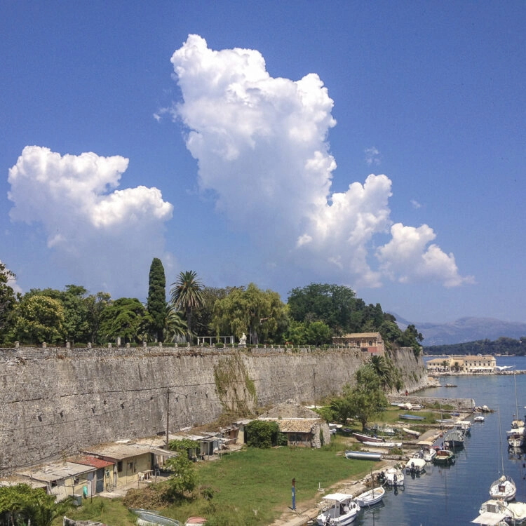

One can clearly see the cloud development upward instead of widthwise, which is typical for thunderstorm situations. The characteristic cloud formation “higher than wide” indicates already in the morning possible thunderstorms in the afternoon. On the left of the poles a first thunderstorm tower is forming.© Thomas Käsbohrer
If the well-known, impressively high cloud towers then actually form from early afternoon, it is already thunderstorming there. From now on it means for the skipper to observe these cloud forms attentively on approach. And above all to get certainty about their direction of migration.
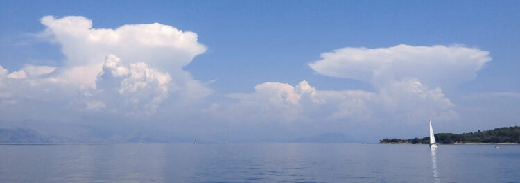

Thunderstorms are now likely. As of now, you should continue to watch the cloud to determine its direction of travel. It will determine whether a ship will enter the thunderstorm.© Thomas Käsbohrer
“Thunderstorm? Can I just sail around it!”
Thunderstorms are very large-scale phenomena, gigantic powerhouses that can span all floors of the Earth’s atmosphere. They can be local, but they can just as easily cover the length of Austria or northern Germany as thunderstorm fronts. And they move fast. Sailing around them? Impossible.
But it is possible to let a thunderstorm pass by. To do this, you have to determine the direction of the storm. That’s easy to do near land, using a bearing mark such as a church steeple or a mountain peak in front of the thunderstorm. This is more difficult with thunderstorms at sea. This is where websites come in handy. For example, wetteronline.de records the latest lightning in seconds and marks it as yellow dots in its rain radar. Lightning occurs clustered in the front part of a thunderstorm front, new lightning in the rain radar points in the direction of the train. This is best done by the page blitzortung.org, which records “old” lightning that occurred longer ago as red dots. Recent lightning is white. So a thunderstorm moves from red to white.
If one knows the direction of the train, one can predict whether a thunderstorm is moving toward a yacht’s location or passing by. It is then the skipper’s decision to wait at sea and let a thunderstorm pass in front of him. Or to sail into the thunderstorm.
“The most dangerous is lightning.”
According to insurance expert Robert Perger of SeaHelp Insurance Broker GmbH, there are remarkably few losses due to lightning strikes on yachts – between 0.1% and 3% of all losses ever reported in a year. Injured or even fatally injured sailors due to lightning strikes were not detectable. Typical damage caused by lightning is shredded clickers and antennas, sooty stays and shrouds at the point of impact, and destroyed on-board electronics. Eyewitnesses report an incredibly loud bang.
More dangerous to any crew are gusts and loss of visibility. Both can lead to what yacht insurers list as common causes of accidents, as opposed to lightning: Grounding and collision. In a thunderstorm between the Croatian islands, if you don’t note your position on the nautical chart beforehand and couple it along, you’ll be in trouble if you lose visibility and your GPS and chartplotter may fail.
“In a thunderstorm at sea, I always leave the sails standing.”
At the latest when hard downbursts from different directions hit the cloth, sails are useless, even a hindrance. And often enough, they tear. Headsails torn by thunderstorm gusts are part of the Croatian thunderstorm summer.
More advisable is: recover sails in time and secure them thoroughly. For this, start the engine to use it as a maneuvering aid in the gusts to turn the boat in time in the gust main direction. Or – if the gusts are too strong – briefly run with the wind in the main gust direction. The prerequisite is sufficient distance from the coast. And to know his location at all times on the basis of the noted position.
More on the topic of “Thunderstorms at sea”
More valuable tips can be found in the SeaHelp articles “What to do when there’s lightning and thunder at sea? ” and “Bora, jugo, nevera/neverin pose different dangers“.
For detailed cloud imagery on higher than wide and how to behave in a thunderstorm, see the book “Thunderstorm Sailing. Seamanship and borderline experience” available as an eBook or print edition.
Tip from the SeaHelp editors:
Severe weather warning for Croatia via push message through the SeaHelp app.
Download SeaHelp app:


