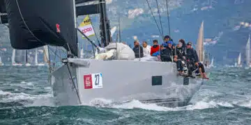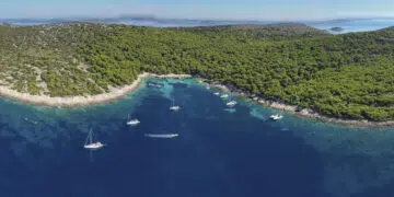
In July and August, thermometers across Europe soar to unprecedented heights. Daytime temperatures of around 35 degrees Celsius are the order of the day in large parts of the Mediterranean and Central Europe, even the nights bring little cooling. SeaHelp has compiled eleven tips on how to enjoy your time on board relaxed and healthy despite the heat. Drink plenty...
Read more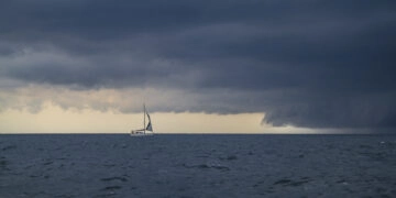
Storms at sea always give anxious moments and questions. To behave properly and give his crew the right answers, here are the biggest misconceptions. "Thunderstorms? Is rare in Croatia. Never experienced it there." Croatia and the northern Adriatic coast are thunderstorm-rich coasts, especially in the summer months. Statistically, lightning and thunder are more frequent in the northern Adriatic than in...
Read more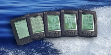
NAVTEX (NAVigational TEXt Messages) is an information service which has been introduced by the IMO for commercial shipping and has passed a functional test for the first time in 1977 in Sweden. Already in 1979, NAVTEX was the first NAVTEX transmitter network put into operation by the Baltic Sea states and with Resolution A.617 (15) already part of the GMDSS...
Read more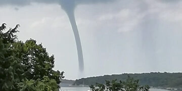
On August 1 and 2, several tornadoes of category F1 swept over Istria, especially the southern tip of the northern Croatian vacation region with Cape Kamenjak / Istria and the region around the port city of Pula / Istria were affected. However, there was no major damage, although in the sky and on the water there was an unusual natural...
Read more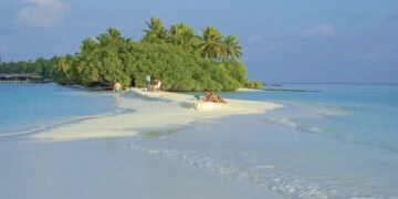
The sea level of the oceans is not constant, but changes continuously. The phenomenon of tides is familiar to all; the average water level seems to remain more or less the same during the short period of a human lifetime. But this is not the case. It can change by a few millimeters, but also in the meter range within...
Read more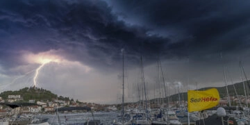
The sky darkens, angry gusts scurry across the water, a dull rumble can be heard and the first flashes of lightning twitch on the horizon: a thunderstorm is on its way. If the storm is already within sight and sound, there is not always enough time to reach a safe harbor or a place in a safe anchorage. With proper...
Read more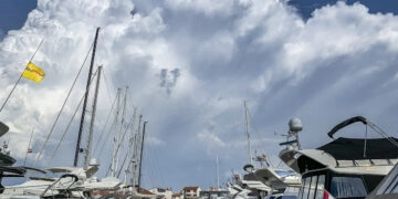
The subject of wind, or the Latin term "Ventus", exerts a not inconsiderable influence on seafaring in the areas of Croatia, Slovenia and northern Italy, depending on the strength measured in Beaufort. For this reason, skippers should familiarize themselves with the peculiarities of the particular area in which they are sailing, because anyone who is not familiar with the harbingers...
Read more
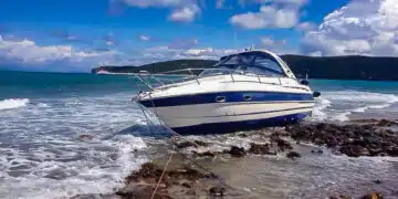
The mystery surrounding the missing gas platform in the Adriatic Sea about 50 kilometers off the Croatian coast near Pula seems to have been solved: According to Croatian media reports, INA confirmed that the Ivana D gas platform was found on the seabed. After helicopters initially circled over the site of the accident but were unable to provide any clues...
Read more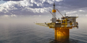
Update 15.12.2020, 23.00 h The missing gas platform Ivana D has been found, the platform sank off the Croatian coast near Pula. Read more. That certain things such as the famous socks in the washing machine or the car keys simply disappear, that is something we have long since come to terms with. But the Croatian petroleum company INA currently...
Read more